Registered Point Clouds
Introduction
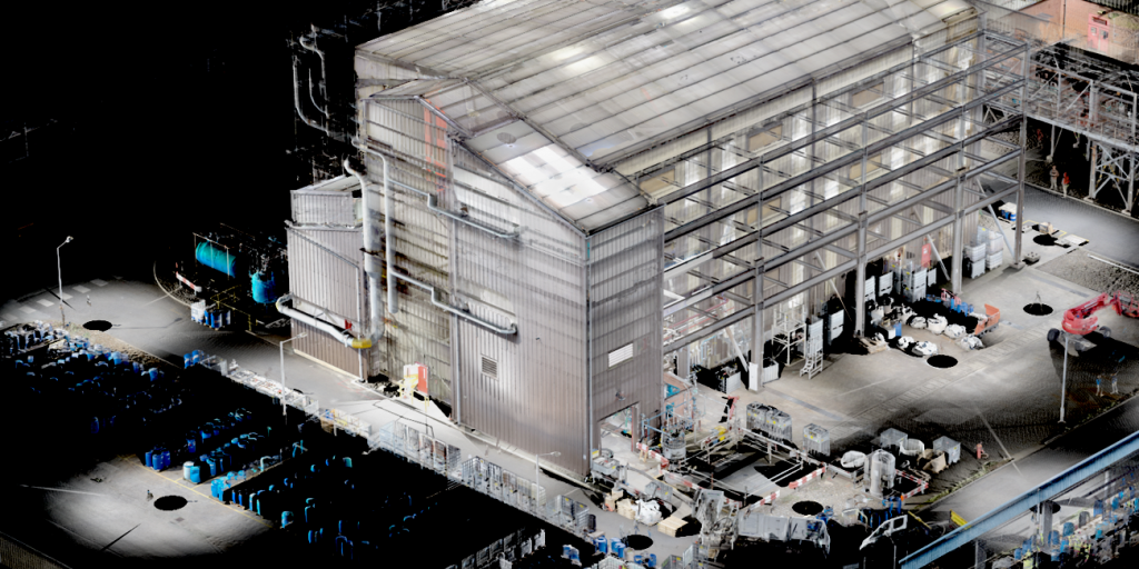
A registered point cloud provides the trusted foundation for engineering design, plant modifications and CAD modelling. Every laser scanning project begins with the capture of individual scans from multiple positions throughout a site. Before this data can be used for engineering, design or visualisation, each scan must be accurately aligned to create a single, coherent point cloud.
At Offset Services, point cloud registration is much more than an automated software process. We combine specialist software, quality assurance procedures and engineering experience to ensure every project delivers a reliable representation of the real world. The result is a trusted dataset that forms the foundation for CAD modelling, plant modifications, asset management and future engineering work.
What is Point Cloud Registration?
A laser scanner captures millions of measurements from a single position. Complex projects may require hundreds or even thousands of individual scans to record an entire facility.
Point cloud registration is the process of accurately aligning these individual scans into a common coordinate system, creating one seamless digital representation of the surveyed environment.
When completed correctly, registration produces a point cloud that can be confidently used throughout the engineering lifecycle.
Why Registration Quality Matters
The accuracy of the final point cloud depends on far more than the specification of the laser scanner itself.
Even small registration errors can become significant across large industrial facilities. Pipework that appears to align correctly within the point cloud may be several millimetres or centimetres out of position if registration quality is poor, increasing the risk of clashes during design and installation.
Reliable registration requires careful survey planning, sufficient overlap between scan positions and rigorous quality checking throughout the registration process.
Poor registration can introduce cumulative errors across large facilities, potentially leading to design clashes, inaccurate measurements and costly mistakes during fabrication or installation.
At Offset Services, every registration project is reviewed to ensure the delivered dataset accurately represents existing site conditions.
Registration is More Than Software
Although modern laser scanners can perform an initial alignment during capture, producing a high-quality registered point cloud still requires experience and careful quality assurance. At Offset Services, every project is reviewed by experienced survey professionals to verify registration quality, identify potential anomalies and ensure the final dataset provides a reliable foundation for engineering decisions.
Registration Quality in Practice
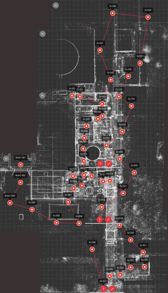
Every registration project produces a comprehensive quality report, allowing our engineers to review the integrity of the scan network before any point cloud is delivered. Rather than relying solely on automated software results, we assess the registration as a complete dataset to ensure it accurately represents the surveyed facility.
Registration Network
Every scan forms part of an interconnected network.
Multiple overlaps improve registration robustness.
Scan links are established, loops closed to improve accuracy.
Survey control can be included when required for large & complex sites or sites where a local grid exists.
Optional GNSS locations included to align scan data to coordinate reference systems such as OSGB36.
Link Quality Assessment
Registration links are analysed.
Registration links are analysed throughout the project, allowing our engineers to quickly identify weaker areas and verify that the overall registration remains robust.
Green indicates successful registration connections.
- 67 Scan Positions
- 212 Registration Links
- 0.378mm Global Network Error
- 82% Registration Network Strength
- 63% Registration Network Overlap
- Independent Visual Inspection
- Senior Engineer Approval
Engineering Review
Before any registered point cloud is released, it undergoes a comprehensive quality review by our survey engineers. We assess both the registration statistics and the dataset itself to ensure it provides a reliable foundation for engineering design, modelling and project delivery.
Quality Assurance
- Every registration undergoes both software validation and independent engineering review before approval for delivery.
- Cloud-to-cloud and target-based registration techniques where appropriate.
- Visual inspection of registration quality.
- Independent verification before delivery.
- Coordinate system validation where required.
Coordinate Systems
Where projects require it, registered point clouds can be aligned to an established site or project coordinate system. This ensures new survey data integrates seamlessly with existing engineering information, allowing designers, contractors and project teams to work from a consistent spatial reference throughout the project lifecycle.
Registration for Large Industrial Facilities
Industrial facilities present unique challenges compared with conventional building surveys.
Large process plants, manufacturing facilities and power stations often contain repetitive pipework, long corridors, congested structures and restricted access areas that require careful planning to achieve robust registration.
Projects containing repetitive steelwork, pipe racks, vessels and complex process equipment require careful planning to maintain registration quality across large areas.
Our experience in complex industrial environments allows us to develop scanning strategies that maximise registration quality while minimising disruption to site operations.
Supporting Engineering Projects
A well-registered point cloud becomes the foundation for a wide range of engineering activities, including:
Typical Project Journey
Every project begins with a laser scan survey and point cloud registration. From there, we tailor the deliverables to your requirements, whether that’s registered point cloud data, CAD models, SmartPanoramics or a combination of these.
Supporting plant modifications, shutdown planning, equipment replacement and brownfield engineering.
Why Choose Offset Services?
- Established in 1982, with over four decades of experience delivering engineering measurement services.
- ISO 9001, 14001 & 45001 certified, providing confidence in quality, environmental and health & safety management.
- Specialists in complex industrial facilities, supporting projects from individual process areas to complete manufacturing plants.
- Proven experience across the UK and internationally, supporting projects in manufacturing, energy, infrastructure and process industries.
- Trusted engineering information, with rigorous quality assurance applied throughout every project.
- Flexible deliverables, from registered point clouds through to CAD models and engineering drawings.
Contact Us
It'd be great to hear from you, get in touch with us here
